
Professional Drone Mapping Services in PA and NJ
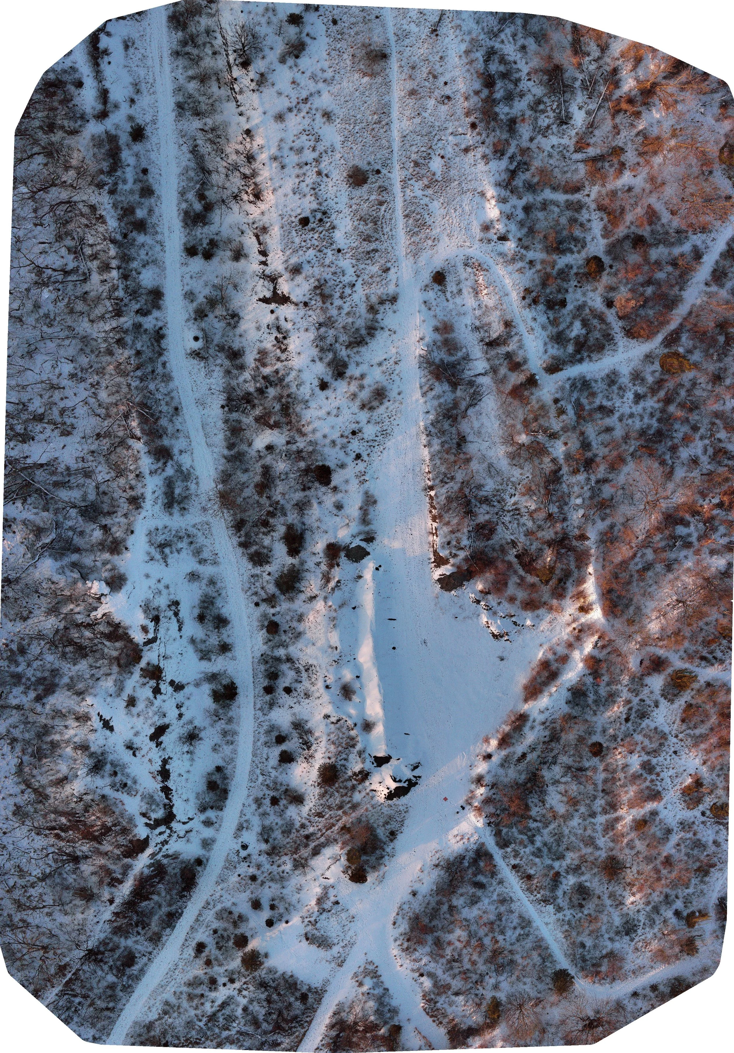
Using drones to create maps using photogrammetry provides valuable information for your land use project. Maps we create provide aerial imagery that is higher resolution, current, and accurate compared to standard satellite imagery. High resolution maps are valuable in industries such as agriculture, infrastructure, and environmental conservation and restoration. If you are a land owner and would like a high resolution map of your land in its current state, we can provide a large file size
We offer:
2D orthophoto maps
3D textured maps
Topographic maps
Surface modeling

Data Deliverables
The following items and file types can be provided
Orthomosaic map: .GeoTIFF, .KMZ
Point cloud: .LAS. LAZ
3D Mesh Model: .OBJ, .FBX
Digital Surface Model (DSM):TIF
2-D Orthomosaic
Orthomosaics are the creation of a high-resolution, georeferenced aerial image where all scale and distortions are corrected. This single, large image is geometrically accurate, acting as a true-to-life base map.
Key Applications
Land use planning
detailed site inspection
pre-construction analysis
tracking job site progress
Environmental monitoring
Floodplane mapping
Vegetation monitoring
Progress Tracking
By flying the same site over time, we create time-lapsed data overlays that clearly show changes, allowing project managers to quickly identify delays, confirm contractor work, and ensure milestones are met.
Resource Management:
Precise volumetric calculations enable you to track inventory levels of aggregates, soil, or other materials with maximum confidence, optimizing procurement and sales.
Engineering & Design
Our topographic and 3D models provide highly accurate base data for architects and civil engineers, reducing the risk of design errors and accelerating the planning phase.
Safety & Compliance:
Detailed orthomosaic maps and 3D models can be used to plan safer access routes, identify potential hazards, and provide documentation for insurance or regulatory purposes.
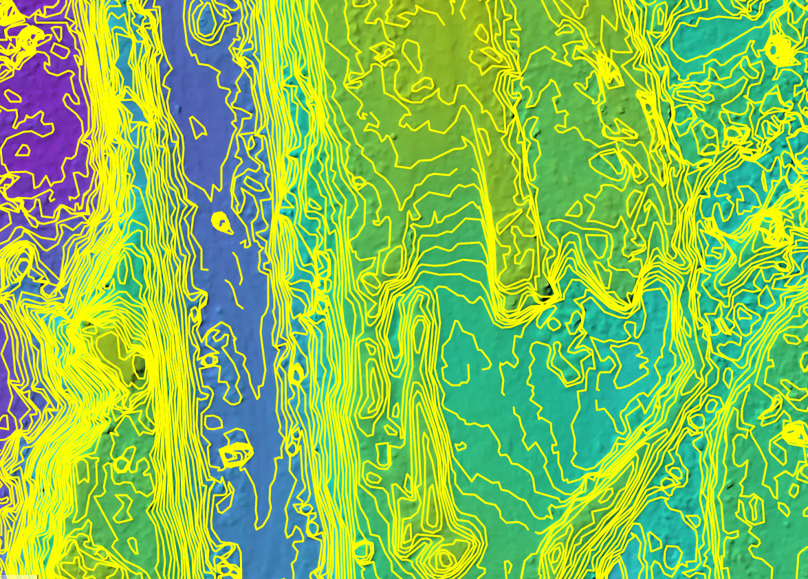
Topographic analysis of site to determine elevations for slope, cut, and fill analysis
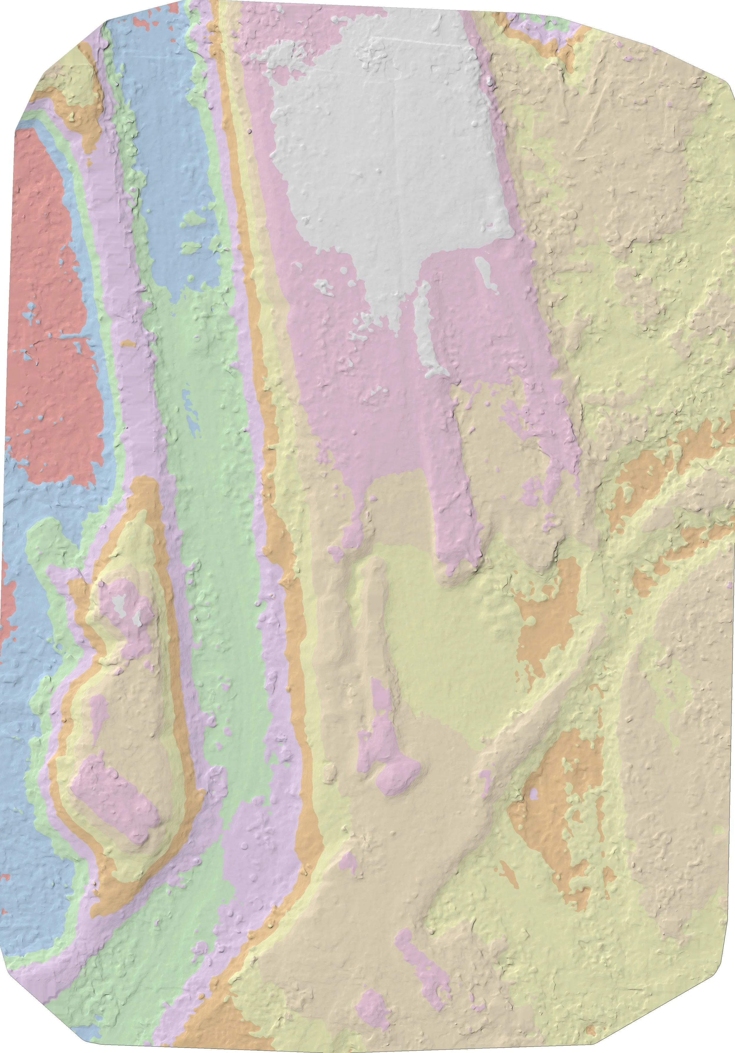
Height map showing elevations. useful for grading and site prep
Mapping of orchard during growing season to see fruiting times and spacing optimization

Orth mosaic of habitat restoration site. Useful for monitoring restoration projects and succession.

Property management for hunting, forestry, and wildlife
See your project from Above
A quick showcase of aerial video of a conservation project highlighting the clarity and detail of maps made vs traditional satellite imagery.
Frequently Asked Questions for mapping
-
Using a drone to create a map results in high resolution and accurate imagery. The imagery is also day of recent as opposed to standard satellite imagery that can be months or years old.
-
Our advanced systems use precise positioning systems using GPS and RTK networks to profide accuracy +-4cm of ground truth.
-
Drone flight time varies by acreage. From a few hours for properties less than 50 acres, and a day for properties more than 100 acres.
Turnaround processing time is fast between 12-48 hours depending on acreage captured.